

Prof. Dr. Begüm Demir

Prof. Dr. Begüm Demir
Research Group Lead
Begüm Demir is currently a Full Professor and the founder head of the Remote Sensing Image Analysis (RSiM) group at the Faculty of Electrical Engineering and Computer Science, TU Berlin and the head of the Big Data Analytics for Earth Observation research group at the Berlin Institute for the Foundations of Learning and Data (BIFOLD). Her research activities lie at the intersection of machine learning, remote sensing and signal processing. Specifically, she performs research in the field of processing and analysis of large-scale Earth observation data acquired by airborne and satellite-borne systems. She was awarded by the prestigious '2018 Early Career Award' by the IEEE Geoscience and Remote Sensing Society for her research contributions in machine learning for information retrieval in remote sensing. In 2018, she received a Starting Grant from the European Research Council (ERC) for her project "BigEarth: Accurate and Scalable Processing of Big Data in Earth Observation". She is an IEEE Senior Member and Fellow of European Lab for Learning and Intelligent Systems (ELLIS).
| 2018 | Recipient of the “2018 Early Career Award” presented by the IEEE Geoscience and Remote Sensing Society. |
| 2017 | Recipient of the Starting Grant from the European Research Council (ERC). |
| 2017 | Recipient of the national accreditation as Associate Professor in Telecommunications in Italy. |
- Remote Sensing
- Machine Learning
- Signal Processing
- Image Processing
- Big Data in Earth Observation
- IEEE Senior Member
- Fellow of European Lab for Learning and Intelligent Systems (ELLIS)
Devis Tuia, Konrad Schindler, Begüm Demir, Gustau Camps-Valls, Xiao Xiang Zhu, Mrinalini Kochupillai, Sašo Džeroski, Jan N. van Rijn, Holger H. Hoos, Fabio Del Frate, Mihai Datcu, Jorge-Arnulfo Quiané-Ruiz, Volker Markl, Bertrand Le Saux, Rochelle Schneider
Artificial intelligence to advance Earth observation: a perspective
Ahmet Kerem Aksoy, Mahdyar Ravanbakhsh, Prof. Dr. Demir Begüm
Multi-Label Noise Robust Collaborative Learning for Remote Sensing Image Classification
Gencer Sumbul, Jun Xiang, Begüm Demir
Towards Simultaneous Image Compression and Indexing for Scalable Content-Based Retrieval in Remote Sensing
Ahmet Kerem Aksoy, Pavel Dushev, Eleni Tzirita Zacharatou, Holmer Hemsen, Marcela Charfuelan, Jorge-Arnulfo Quiané-Ruiz, Begüm Demir, Volker Markl
Satellite Image Search in AgoraEO
BIFOLD appoints new Deputy Directors
BIFOLD appoints Prof. Dr. Begüm Demir, Prof. Dr. Konrad Rieck and Prof. Dr. Alexander Meyer, as BIFOLD Deputy Directors. With this decision, BIFOLD strengthens its leadership team and underlines its commitment to advancing cutting-edge research in data-driven technologies and machine learning.

BIFOLD at WACV 2026
BIFOLD researchers of the Big Data Analytics for Earth Observation group will present GeoRank: a novel method that embeds geographical relationships into self-supervised learning for multispectral satellite imagery, consistently improving state-of-the-art algorithms.

Ask Agent-BigEarth
Begüm Demir, Professor of Remote Sensing Image Analysis at TU Berlin and research group lead at BIFOLD (Berlin Institute for the Foundations of Learning and Data), has secured one of the coveted Proof of Concept grants from the European Research Council (ERC). These grants aim to bridge the gap between fundamental research and practical applications, helping to transform pioneering research results into tangible societal or commercial benefits.
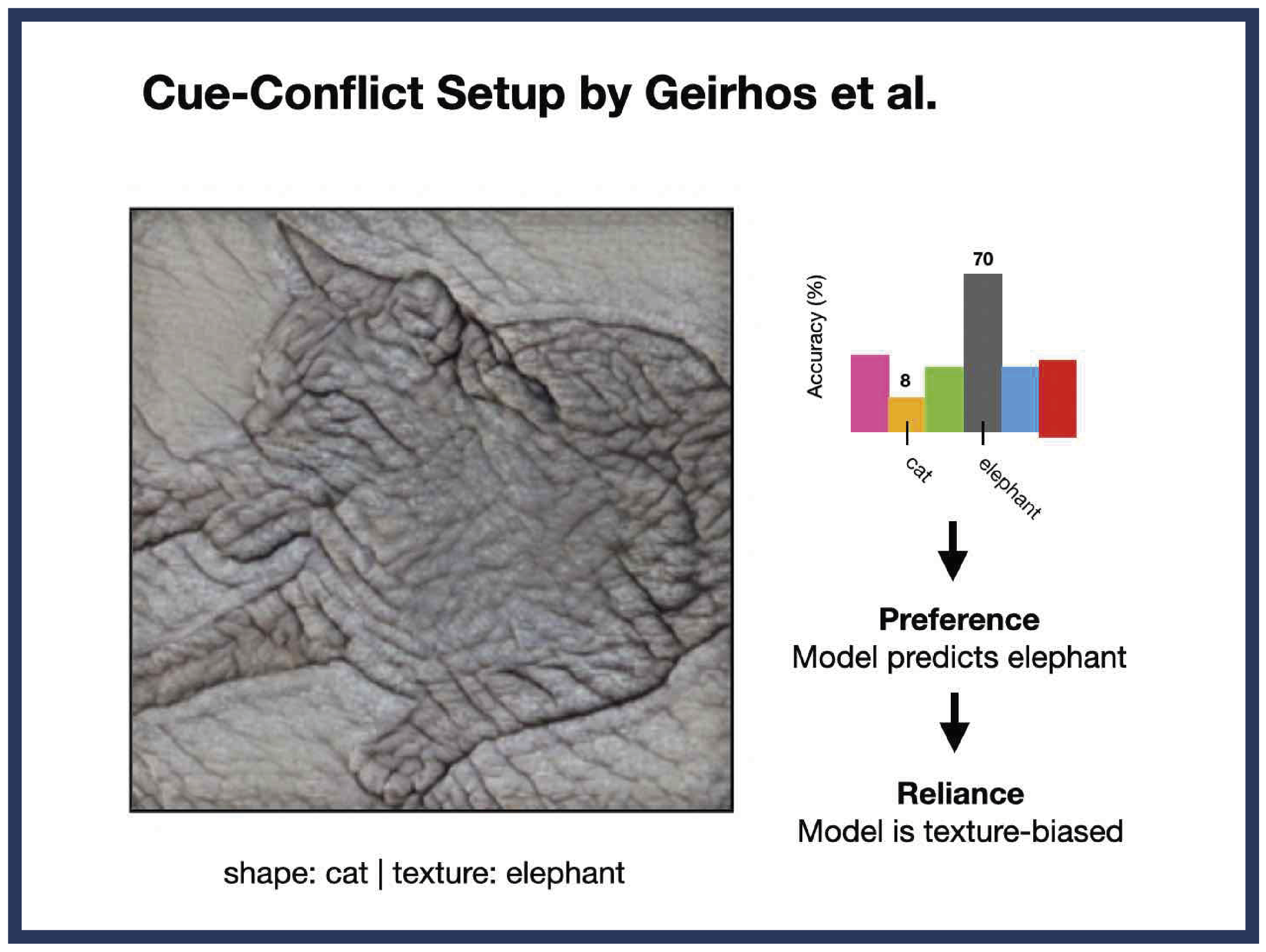
Rethinking how models "see"
Congratulations to BIFOLD researchers Tom Burgert, Oliver Stoll, and Begüm Demir from TU Berlin, and Paolo Rota from the University of Trento. They published a new study, that revisits a central claim in computer vision: so-called convolutional neural networks (CNNs) primarily rely on texture, rather than object shape, to recognize images. The publication was accepted as an oral presentation at NeurIPS 2025.
IGARSS 2025 Conference Contributions
Researchers from BIFOLD’s RSiM and DIMA groups will present a total of six papers and organize a community-contributed session at the IEEE International Geoscience and Remote Sensing Symposium (IGARSS 2025) taking place from August 3rd to August 8th in Brisbane, Australia.

News from the BigEarth Group at BIFOLD
BIFOLD’s BigEarth group shares key updates: EGU panel on digital tech, keynote at BEODay, contributions to ESA–NASA AI workshop, and a new ESA feature on the digital assistant for Earth observation data.
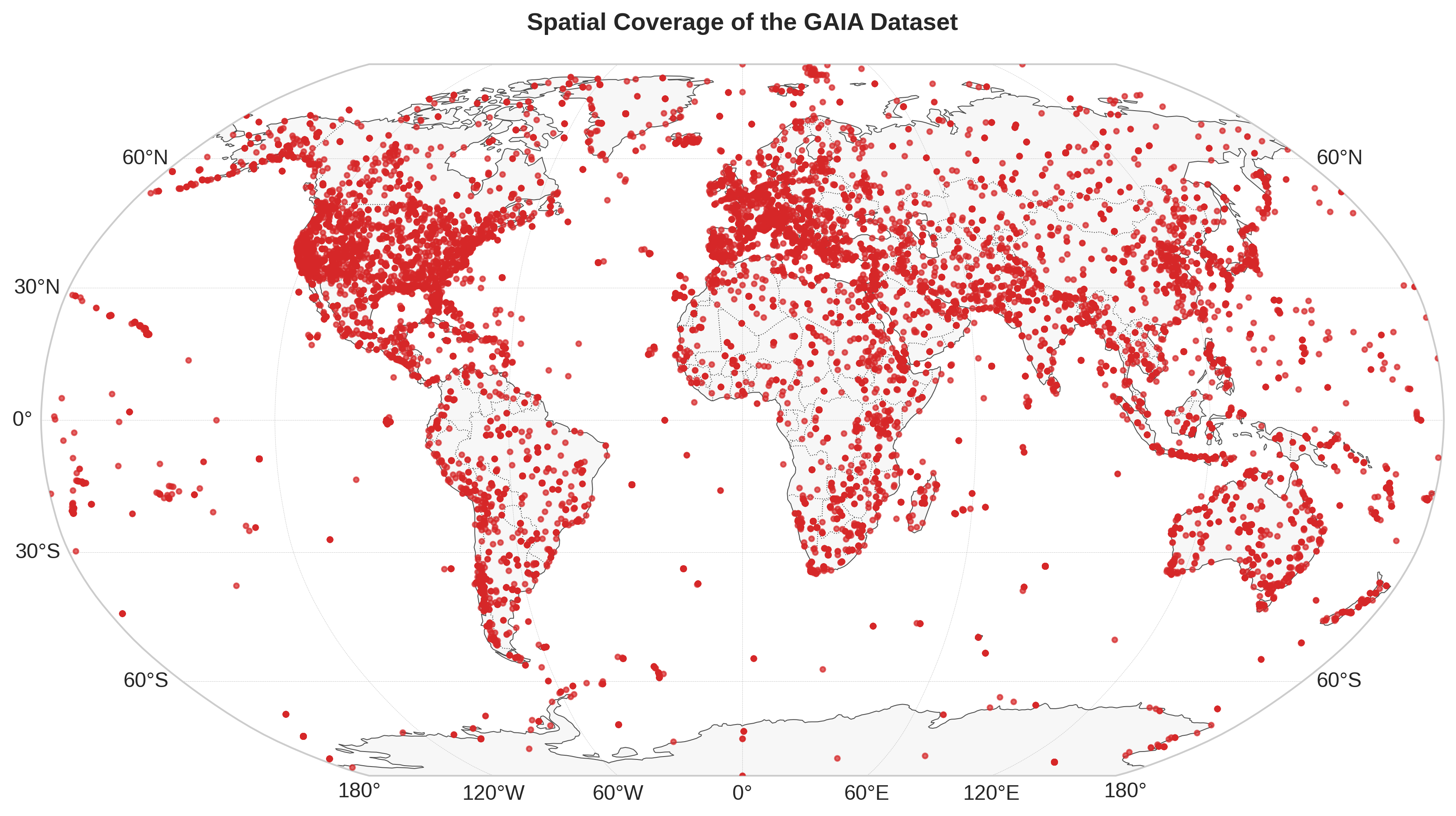
Interpreting Earth with GAIA
Angelos Zavras, PhD candidate at the Harokopio University of Athens, used his short-term research grant from the DAAD to spend time in Berlin as part of the Remote Sensing research group at BIFOLD. Together with Prof. Begüm Demir and her team he developed GAIA.
BigEarth Project reviewed by CORDIS
The BigEarth Project, led by Prof. Dr. Begüm Demir, has been featured by CORDIS.

BIFOLD at IGARSS 2024
BIFOLD research group Big Data Analytics for Earth Observation (BigEarth), led by Prof. Begüm Demir, presented four papers at the IEEE International Geoscience and Remote Sensing Symposium (IGARSS 2024) in Athens, Greece. IGARSS 2024 scientific program focused on sustainable development in line with the United Nations 2030 Agenda.
Videos of the "ML& DM for Earth Observation" Workshop
The videos from the "Machine Learning and Data Management for Earth Observation" workshop are now accessible online. During the workshop leading experts discussed cutting-edge advancements in satellite technology, machine learning, and data management. Explore or review 12 compelling sessions.
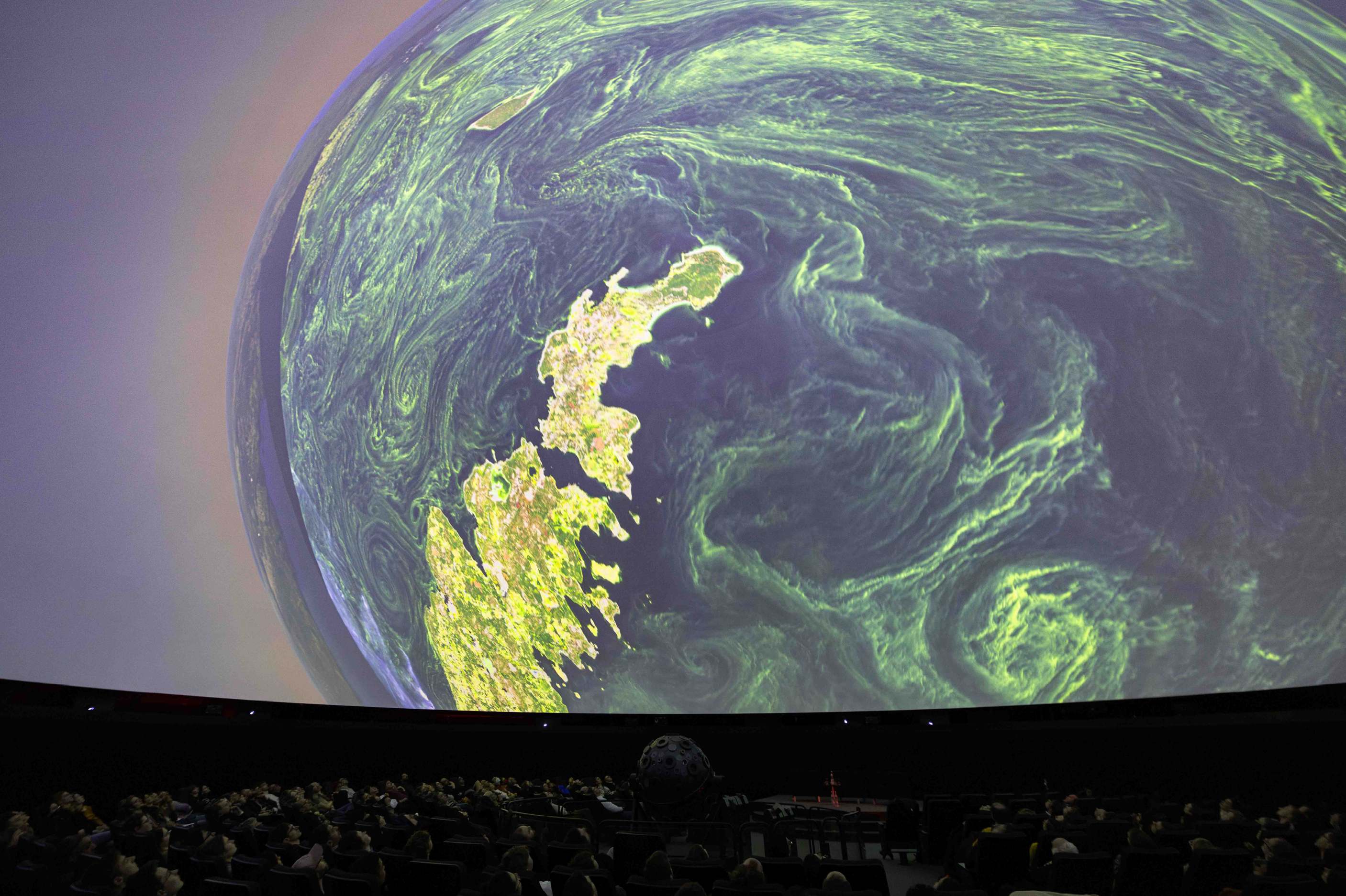
Smart Sky: Transforming Earth Observation through AI
Through three engaging lectures, scientists from NASA, the Planetarium Berlin, and BIFOLD explained the significance of satellite images and modern AI techniques.

New open research positions
Join BIFOLD and collaborate with renowned experts on cutting-edge Machine Learning and Data Management research! Develop robust, trustworthy, and sustainable AI solutions with our team of international scientists.
Research from the very top
BIFOLD scientist Prof. Dr. Begüm Demir explains the benefits of using Explainable Artificial Intelligence (XAI) to enhance earth observation satellite data analysis in the Tagesspiegel TU Berlin supplement.

DA4DTE: Pioneering Satellite Data Archives with a Revolutionary Digital Assistant
Demonstrator Precursor Digital Assistant Interface for Digital Twin Earth (DA4DTE) is a project by the European Space Agency (ESA) that aims to simplify the usage of satellite data archives. A BIFOLD research group led by Prof. Dr. Begüm Demir has been pivotal in developing three of the four search engines featured in the digital assistant.
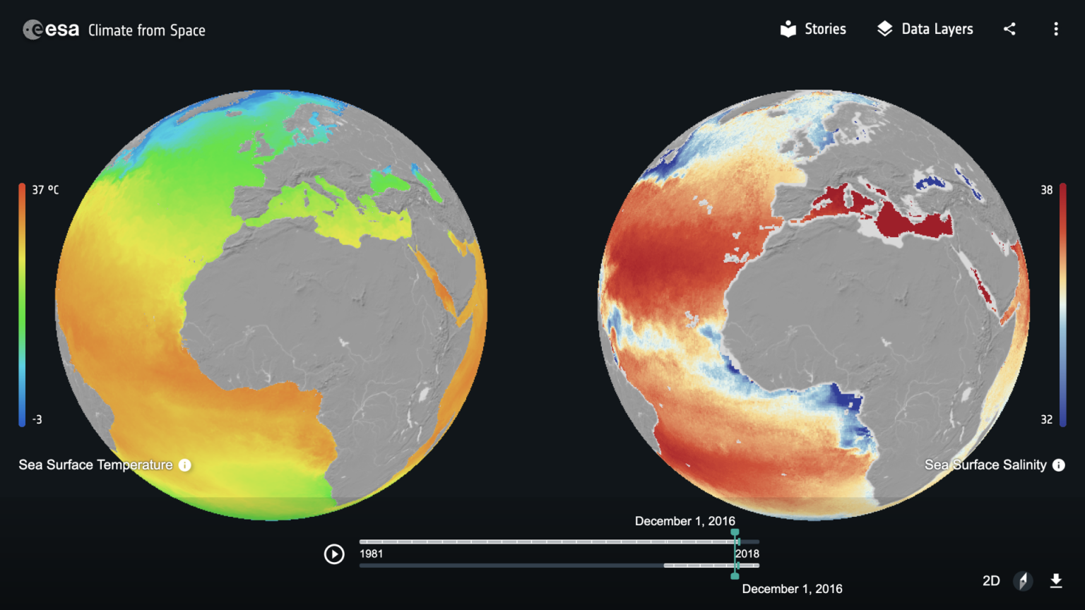
Earth Observation data for Climate Change research
Many environmental reports are based on the analysis of satellite images. BIFOLD researchers are creating AgoraEO, an infrastructure for Earth Observation (EO) data that enables federated analysis across different platforms, making modern EO technology accessible to all scientists and society, thus promoting climate change innovation worldwide.
An overview of the current state of research in BIFOLD
Since the official announcement of the Berlin Institute for the Foundations of Learning and Data in January 2020, BIFOLD researchers achieved a wide array of advancements in the domains of Machine Learning and Big Data Management as well as in a variety of application areas by developing new Systems and creating impactfull publications. The following summary provides an overview of recent research activities and successes.